The SSD crew stabilizes the SSD for recovery to the back deck of the R/V Pelican.
Who says you can’t make something already good even better? Certainly not marine-systems specialists who are at the University of Mississippi, working with their upgraded and improved robotic Station Service Device, or SSD, which is a Remotely Operated Vehicle, or ROV, designed to perform basic functions necessary to marine research.
Designed and built in 2006 by the Mississippi Mineral Resources Institute at UM and Specialty Devices Inc. of Wylie, Texas, to service the Woolsey Mound Seafloor Observatory in the northern Gulf of Mexico, the SSD made its first dive to 900 meters in 2007. During that mission and subsequent missions, the SSD has been used to deploy, relocate, tow and recover instruments on and from the seafloor, collect samples, make and break underwater connections, and locate, photograph and survey seafloor features and instruments.
Rapid-response funds, made available from the Northern Gulf Institute, were awarded in the wake of the Deepwater Horizon oil spill to upgrade the vehicle to explore seafloor conditions in water depths up to 2,000 meters. To meet this goal, nearly every system on the ROV has been improved and/or modified, including the electrical, hydraulic, ballast and instrument packages (sonar, altimeter, cameras and lights). Efforts continue to increase the reliability of the vehicle by isolating individual circuits and building in fail-safe systems.
Starting in 2011, the vehicle underwent a six-month major overhaul to expand its capabilities and enable it to dive to greater depths. When the upgrades were complete, the SSD was taken to Southwest Research Institute, a large pressure-testing facility in San Antonio, Texas, to be certain that the vehicle and all its functions could survive the pressures encountered at 2,000-meter water depth. Last summer, it was used on a successful mission of the Ecosystem Impacts of Oil and Gas Inputs to the Gulf, or EIOGIG, oil spill project administered by the National Institute for Undersea Science and Technology (NIUST), also at the University of Mississippi.
“The specific operations called for the SSD to dive on a lander, fabricated by MMRI’s shop and equipped with ECOGIG instruments, and place selected instruments on the seafloor adjacent to the lander,” said Greg Easson, MMRI director. “At 1,600 meters versus the previous 900 meters, the ROV dove deeper than ever before and moved more equipment on the seafloor than ever before.”

The SSD, aft view, is ready for deployment as a survey vehicle.
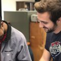
The team working with the upgraded ROV includes MMRI staff members and marine-systems specialists Matt Lowe, Brian Noake and Andy Gossett (now in mechanical engineering), electronics technician Larry Overstreet, research associate Steven Tidwell and GIS specialist and navigator Marco D’Emidio. Rounding out the crew are Max Woolsey and Roy Jarnagan from NIUST and Paul Higley and Scott Sharpe from Specialty Devices Inc.
ROVs are used heavily in marine research and industry to explore and monitor marine activities and operations. They are much more efficient and safe than manned submersibles and far less expensive to operate.
“On last July’s mission in Mississippi Canyon, the SSD was launched from the R/V Pelican for the purpose of servicing the ECOGIG lander that had been collecting geochemical data near the Macondo wellhead for several months,” said Carol Lutken, MMRI associate director and chief scientist on the mission. “As we approached the location we had been given, it became clear that the lander was not where we had been told we would find it. The high-resolution scanning sonar on the SSD was critical for locating the lander, which we found 115 meters from the target location. Finding it was possible only because we use highly accurate navigation, scanning sonar (with [approximate] 100-meter scanning radius), multiple lights and cameras, and a highly skilled team of professionals dedicated to the project and who work expertly together.”
The SSD was flown out to the lander, where it did a short video survey of the lander and its instruments. Then the SSD removed the Chimney Sampler Arrays from the lander and placed them on the seafloor about 10 meters apart.
“The device’s new camera system made the operations of releasing and grabbing the CSA a nearly effortless task compared to the former, two-dimensional view under which the operation has been executed in the past,” Lutken said. “The increased payload of the second CSA posed no problem as the SSD had more than enough lift to move the array.”
The SSD’s next mission is scheduled for March 3-7, when it will be part of an ECOGIG cruise. The main purpose of the cruise is to deploy two landers on the seafloor at Green Canyon 600, a known site of natural hydrocarbon seepage in the northern Gulf of Mexico. The landers are equipped with geochemical sensors designed to assess the water chemistry in the water column and at the seabed. The SSD will be used to survey the area for appropriate locations for the landers.